Capt. Segull Nautical Charts
Captain Segull's Sport Fishing Charts cover the North American coastline from the Penobscot Bay, Maine south to Louisiana and Texas, including Bahamas and Cuba and into the Gulf of Mexico!!! Reprints of charts continue being done.
Captain Segull's Charts are designed for the serious sport fisherman. They show you fishing spots, that will help you catch fish. All charts are laminated, waterproof and in full color. Average Large chart size is 19" X 26", small boat/kayak charts 12" x 18". Charts highlight: latitude and longitude (GPS), Loran lines, contour lines, shore services such as fuel docks, loading ramps, kayak launches, pump-out stations and restaurants. Also highlighted are fishing holes with local names, coordinates of buoys, inlets, reefs, rigs and wrecks. If you want to know where to catch fish, get your own Captain Segull's Sport Fishing Chart. We have offshore charts, inshore charts, nearshore charts, bathymetric charts (color contoured by depth), species identification charts and new small boat/kayak charts. Please click on your geographic location for charts in your area.
- Product
- Qty in Cart
- Quantity
- Price
- Subtotal
-

Small Boat/Kayak: Housatonic River and Milford Harbor, CT
$11.95Small Boat/Kayak Inshore fishing chart, double sided, laminated, 12 x 18 inches, Connecticut Detail of the Housatonic River includes Milford Harbor$11.95 -

Offshore: Canyon chart off MA, RI, CT, NY
$18.50Offshore - 90 to 100 miles off coast, Double sided, laminated, 19 x 26 inches. MA, RI, CT, & NY. Side A: from Nantucket$18.50 -
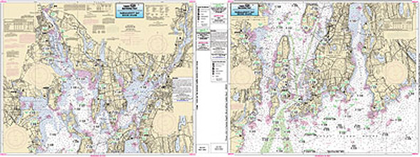
Inshore: Narragansett Bay, RI
$18.50An inshore chart 1-2 miles off the coast detailing the bays Chart is 19 x 26 inches, double sided, and laminated. Rhode Island coastline. &nbs$18.50 -

Small Boat/Kayak: Little Narragansett Bay and Pawcatuck River CT, RI
$11.95Small Boat/Kayak Inshore fishing chart, double sided, laminated, 12 x 18 inches, CT, RI, NY Detail of the Pawcatuck River n$11.95 -

Nearshore/Inshore: Block Island Sound/Fisher's Island, NY
$18.50Detais the bays and Islands. Chart is 19 x 26 inches, double sided, and laminated. Rhode Island, Connecticut & New York.$18.50 -

Inshore: Coast of CT, Fisher's Island
$18.50An inshore chart 1-2 miles off the coast detailing the bays Chart is 19 x 26 inches double sided and laminated$18.50 -

Small Boat/Kayak: Connecticut River, CT
$11.95Small Boat/Kayak Inshore fishing chart, double sided, laminated, 12 x 18 inches, Connecticut Detail of the mouth of the Conn$11.95 -

Bathymetric Nearshore Block Is. Shelf and Coastal NY and NJ
$18.50Bathymetric - color contoured by depth - Double sided, laminated, 19 x 26 inches, Nearshore, RI, CT, NY, NJ area Nears$18.50 -

Nearshore/Inshore: Buzzards Bay, MA18.50
$18.50Detais the bays and Islands. Chart is 19 x 26 inches, double sided, and laminated. Massachusetts & Rhode Island.$18.50 -

Placemat: Martha's Vineyard and Nantucket Placemat
$11.9512" x 18" thick double sided Laminated Nautical Placemat. Massachusetts One side highlights Martha's Vineyard with light houses of the area. Other side highlights Nantucket with light...$11.95 -


Offshore: Gulf of Maine, Massachusetts Bay..
$18.50Offshore chart off 90 to 100 miles off coast, double sided, laminated, 19 x 26 inches, Maine, New Hampshire, and Massachusetts,$18.50 -

Inshore: Cohasset Harbor to Manomet, MA
$18.50Inshore chart 1 to 2 miles off the coast double sided, laminated, 19 x 26$18.50